Alamut: Seven Fortresses, One State
Caption
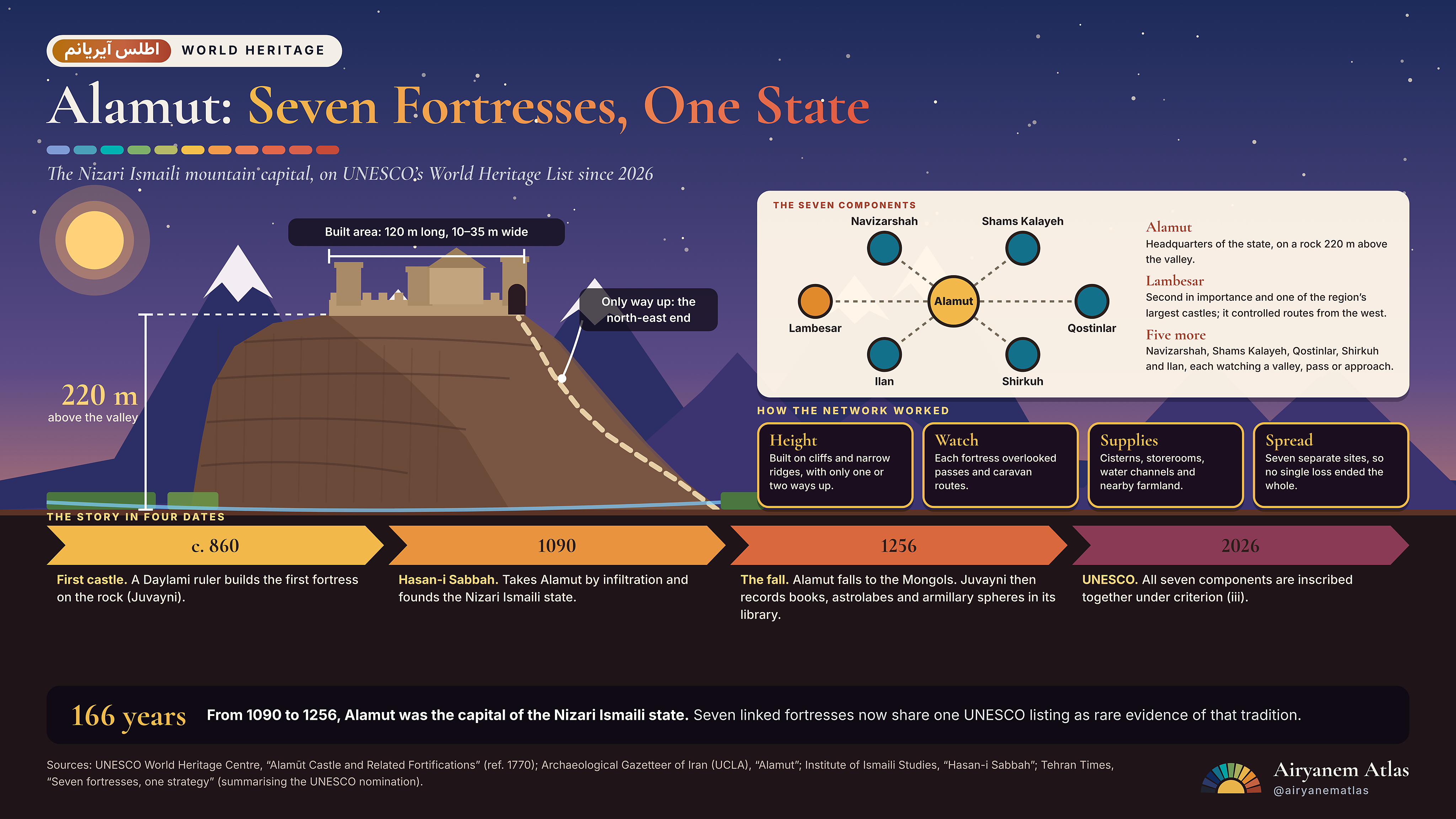
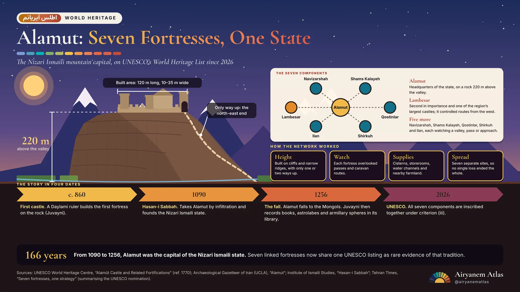
Alamut: seven fortresses, one state. From 1090 to 1256 a rock in the Alborz, 220 m above the valley, was the capital of the Nizari Ismaili state, ringed by six more fortresses. In July 2026 UNESCO inscribed all seven together. #Alamut #WorldHeritage #Iran
Short takes
When the Mongol court historian Juvayni visited Alamut after its capture in 1256, he recorded scientific books and astronomical instruments in the library, among them astrolabes and armillary spheres.
Alamut’s rock stands about 220 m above the valley, yet the built area is only 120 m long and 10 to 35 m wide. Precipices on every side leave the north-east end as the only way up.
Alamut was studied long before UNESCO. Vladimir Ivanow surveyed it in 1957–58, and a restoration and excavation project led by Hamideh Chubak ran from 2001 to 2013, recovering Saljuq and Ilkhanid glazed pottery.
Image description
Illustrated infographic titled Alamut: Seven Fortresses, One State. On the left a brown rock with a walled castle on top rises from a green valley under a violet dawn sky. Dimension lines mark 220 metres above the valley and a built area 120 metres long and 10 to 35 metres wide. A dashed path climbs to the gate at the north-east end. On the right a diagram shows Alamut in gold at the centre linked to six teal and orange nodes: Lambesar, Navizarshah, Shams Kalayeh, Qostinlar, Shirkuh and Ilan. Four cards explain how the network worked: height, watch, supplies and spread. A four-step timeline runs c. 860, 1090, 1256 and 2026. A bottom bar reads 166 years, the span from 1090 to 1256.